Trek And Hiking in Jebel siroua Morocco
Trek in the heart of Jebel Siroua, land of saffron.
Réf : TREKS8
Overview:
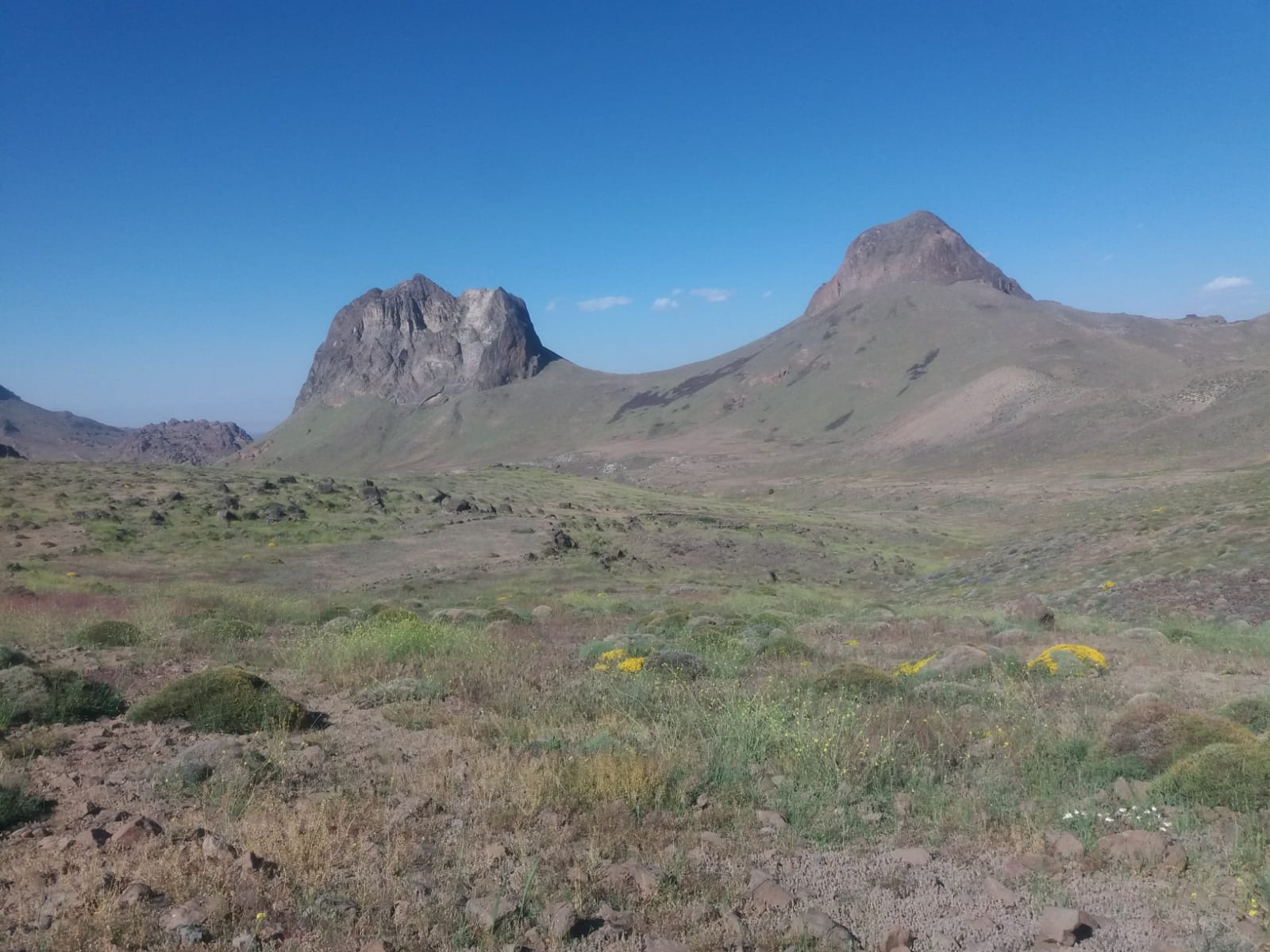
Discover the wild beauty of Jebel Siroua, a lesser-known volcanic mountain range nestled between the High Atlas and Anti-Atlas in southern Morocco. Known as the “land of saffron,” this unique region offers a stunning combination of dramatic volcanic landscapes, remote Berber villages, terraced valleys, and high pastures dotted with sheep and goats.
This 8-day trek takes you deep into the heart of Siroua, where you’ll explore rugged ridgelines, panoramic summits, and ancient transhumance trails. The highlight is the ascent of Jebel Siroua (3,304m), offering spectacular views over the surrounding mountain ranges and the vast Sahara beyond.
Along the way, you’ll experience authentic Amazigh (Berber) hospitality, sleep under the stars or in traditional village houses, and taste local dishes flavored with the region’s most famous spice—saffron.
Detail Trek siroua 8 days PRICE FROM : 599 €
- Activity : trek Accommodation : Tent Livel : Middel+++
- Min age : 18 years
ITINERARY : TREK AND HIKING IN DJEBEL SIROUA MOROCCO 8 DAYS.
Day 1: Marrakech / Ait Tigga
Transfer by minibus, 4 hours drive, picnic lunch, overnight in camp in Ait Tigga Village.
Day 2: Ait Tigga / Azib Iriri (2300 m)
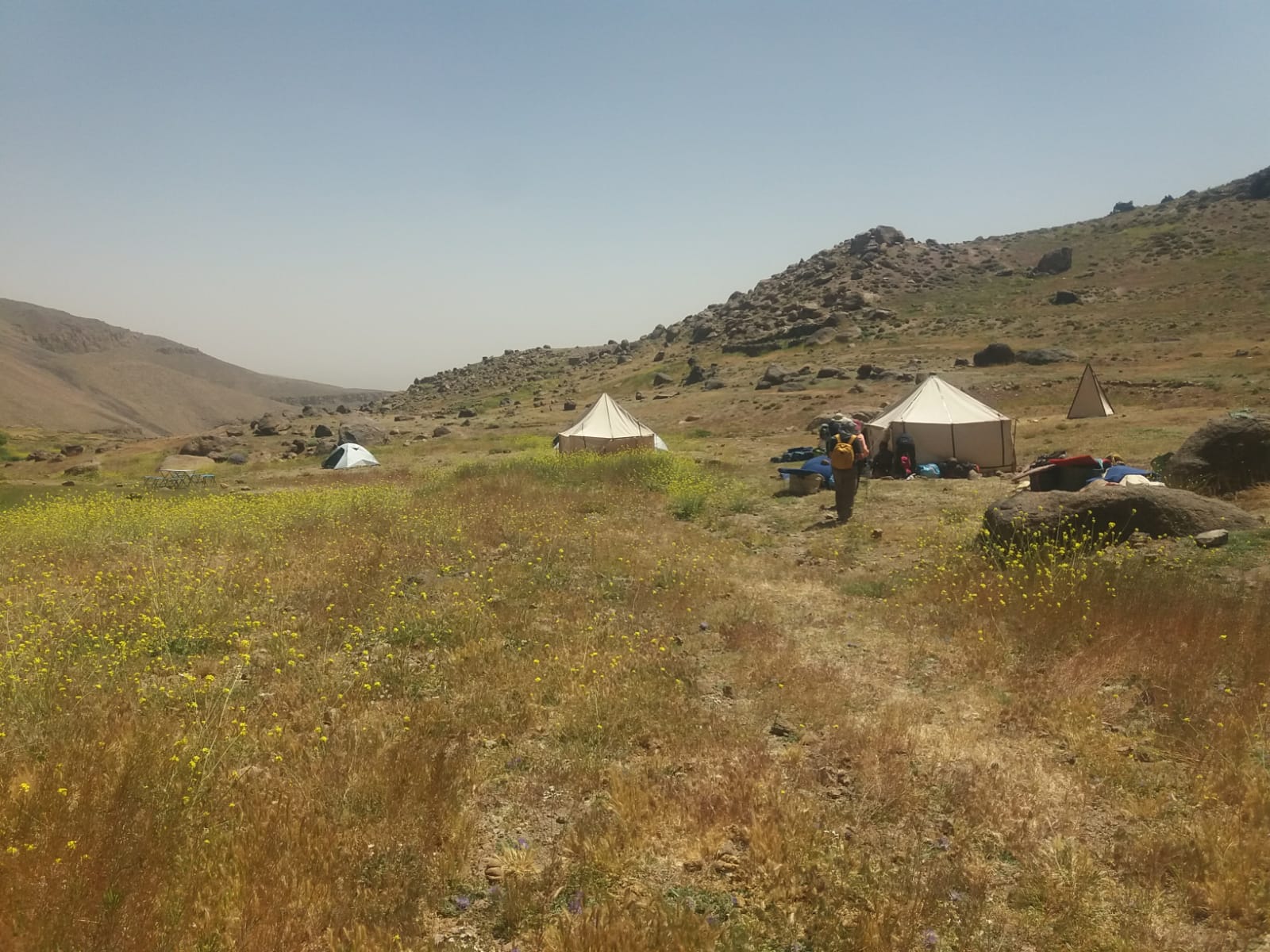
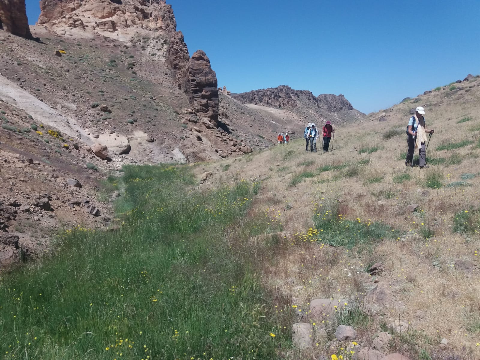
From Aït Tigga to Azib Iriri, the trail gradually ascends from cultivated valleys to the high volcanic plateaus of the Siroua. Passing terraced fields and following dry riverbeds, the route offers glimpses of rural life. As altitude increases, vegetation fades, giving way to alpine pastures used by nomadic shepherds. Panoramic mountain views and encounters with transhumant herds are possible. Bivouac overnight. 6 hours of walking.
Day 3: Iriri / Azazegzan(2400 m)
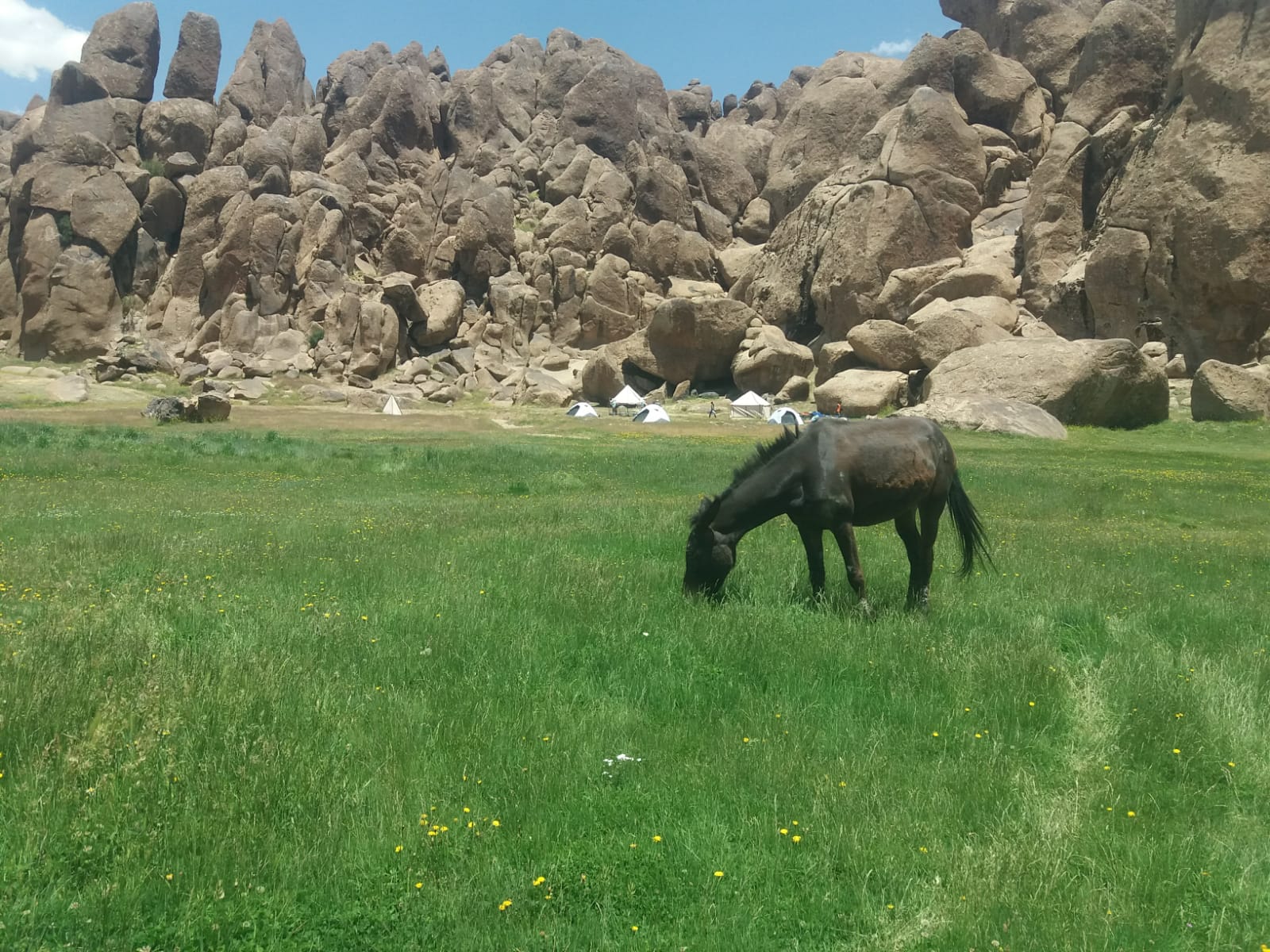
From Azib Iriri (2,300 m), the trail ascends into the wild volcanic landscapes of Siroua, heading to Azib Azazegzane, a high-altitude shepherds' camp. The path crosses rocky valleys and sparse plateaus, with views of surrounding peaks, including Jbel Siroua. Encounters with nomadic herders and flocks are possible. Bivouac at 2,500 m in a remote, scenic setting. 5 hours of walking.
Day 4: Azazgezan / Iferd Magos (2800 m)
From Azib Azazegzane (approx. 2,500 m), the trail leads gently to Iferd Magous, skirting Jbel Siroua without ascending it. The route follows a high balcony path through typical volcanic scenery—plateaus, arid valleys, sculpted dark rocks, and alpine pastures used by nomads. The walk is moderate, with steady but easy climbs and descents. Silence reigns, broken only by wind or distant bells. Distant views of Jbel Siroua and southern valleys add to the experience. Arrival at Iferd Magous (approx. 2,800 m), a seasonal nomadic pasture, offers peace and space for rest. A quiet, remote bivouac. 6 hours of walking.
Day 5: Iferd Magos / Tagragra(2300 m) / Iriri)
From Iferd Magous (approx. 2,600 m), the trail climbs gradually through a barren volcanic landscape toward the summit of Jbel Siroua. The path winds through rocky domes and stone slopes, becoming steeper and looser near the top. The ascent is non-technical but requires good fitness. At 3,304 m, the summit offers stunning views: snow-capped High Atlas to the north, and desert foothills of the Anti-Atlas to the south. A highlight of the trek. Descent to Tagragra follows a different, steeper route on the southeast side, with rocky sections to navigate carefully. As altitude drops, the scenery softens, turning greener in season. Tagragra (approx. 2,400 m) is a peaceful grazing area with dry-stone shelters and nomad camps, ideal for bivouac. 6 hours of walking.
Day 6: Tagragra/ Azib Tizgui (2000 m)
From Tagragra (approx. 2,400 m), the trail climbs steadily toward Jebel Guiliz, a lesser-known but scenic peak of the Siroua range. The ascent crosses mineral and grassy terrain, dotted with wind-sculpted rock formations. At around 2,900 m, the summit offers wide, peaceful views over the massif, nearby valleys, and the High Atlas to the north. After a summit break, the descent leads to Azib Tizgui through high pastures and narrow valleys. Located at 2,200–2,300 m, Azib Tizgui is a traditional seasonal camp used by nomadic shepherds. Surrounded by green slopes and often near a spring, it’s a quiet, restful spot for a bivouac after a scenic and rewarding day. 5 hours of walking.
Day 7: Azib Tizgui/ Tizgui village/Ait Oubyal valley night in local house in Tiselite village
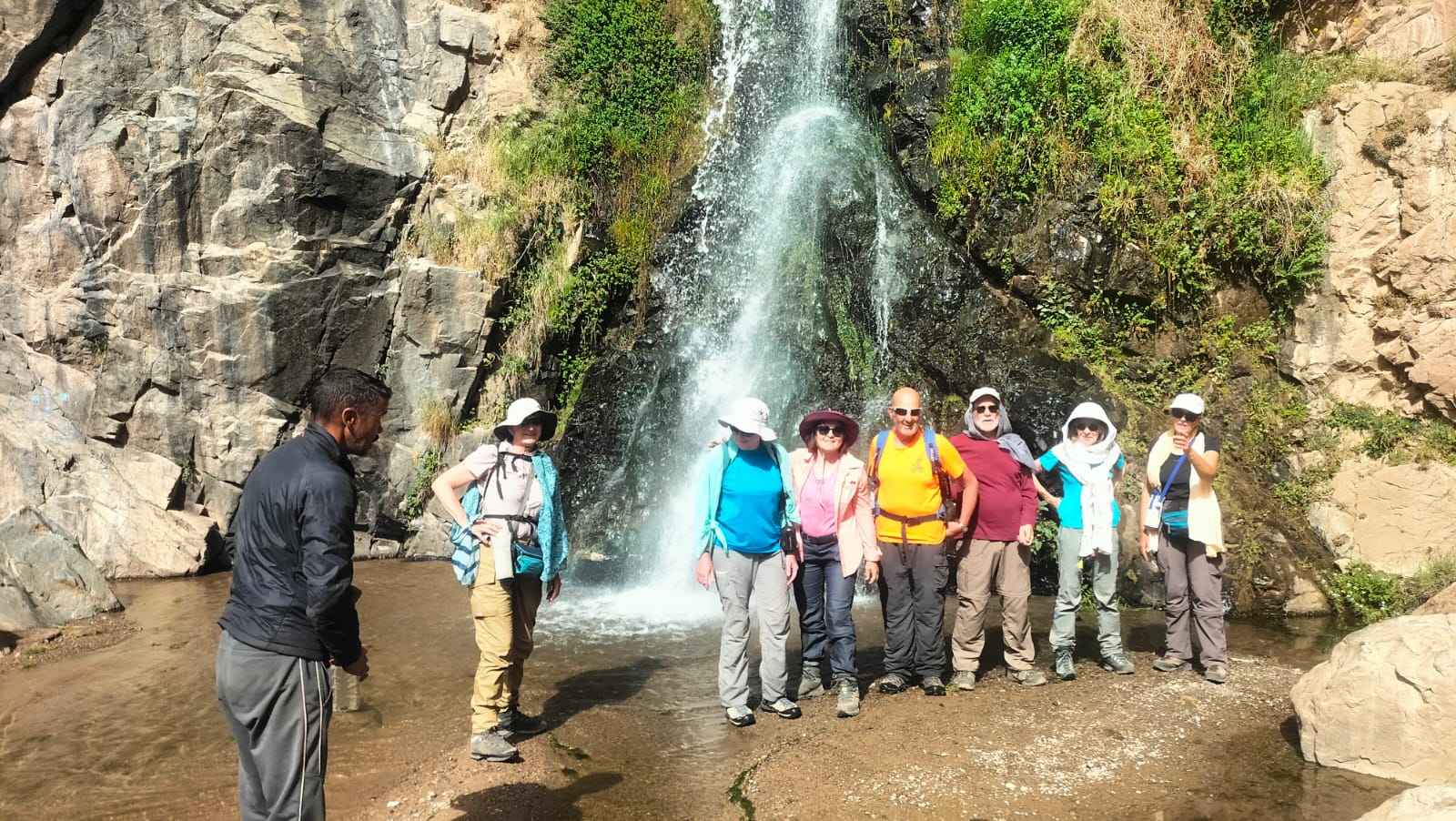
From Azib Tizgui (approx. 2,200 m), the trail descends gently through alpine pastures toward the lush valley and village of Tizgui. The landscape becomes more cultivated, with barley fields, almond trees, and terraced farms marking a return to settled life. A short detour leads to the Tizgui waterfalls—a refreshing spot nestled in green valley vegetation. The route continues into the fertile Aït Oubyal valley, dotted with earthen villages, irrigated gardens, and well-used mule trails. The atmosphere becomes livelier and more human. Encounters with friendly locals are common. The stage ends in the village and gorges of Tislite, where you can stay in a local home or guesthouse. Peacefully set on the Siroua foothills, Tislite offers a warm Berber welcome and a tranquil setting—an ideal end to the trek. 5–6 hours of walking, bivouac.
Day 8: Tislit/souk laarba/Marrakech.
La dernière journée du trek commence par une courte marche de liaison entre le village de Tislite et Laarbaâ, souvent utilisée comme point de sortie du massif du Siroua. Le sentier descend doucement à travers les derniers vergers, cultures en terrasses et petits hameaux berbères. La végétation est plus dense, les paysages plus doux et les villages plus rapprochés, signe du retour vers les basses altitudes. Laarbaâ N’Tazart (ou simplement Laarbaâ), est un petit centre rural local où l’on retrouve la route carrossable. C’est généralement ici que vous retrouvez le minibus pour le transfert retour vers Marrakech. 45 mn a pied et 5 h en voiture.
Highlights:
- The fortified villages: Amasin village, Tamlakoute village, Ait Tiga, Tizgui village and these beautiful collective granaries
- The ascent of Jebel Siroua (3305 m)
- Visits to the Tisli gorges, the high altitude azibes.
Tour period: May to October
Price per person Arrival and departure Marrakech:
- Price per person based on 2/3 pax: 699 euros/person
- Price per person based on 4/8 pax: 650 euros/person
- Price per person based on 9/15 pax: 599 euros/person
INCLUDED:
- Full board during the hike
- Round-trip minibus transfers
- Round trip airport transfer
- Guide service
- Cook service
- Transport for equipment and food.
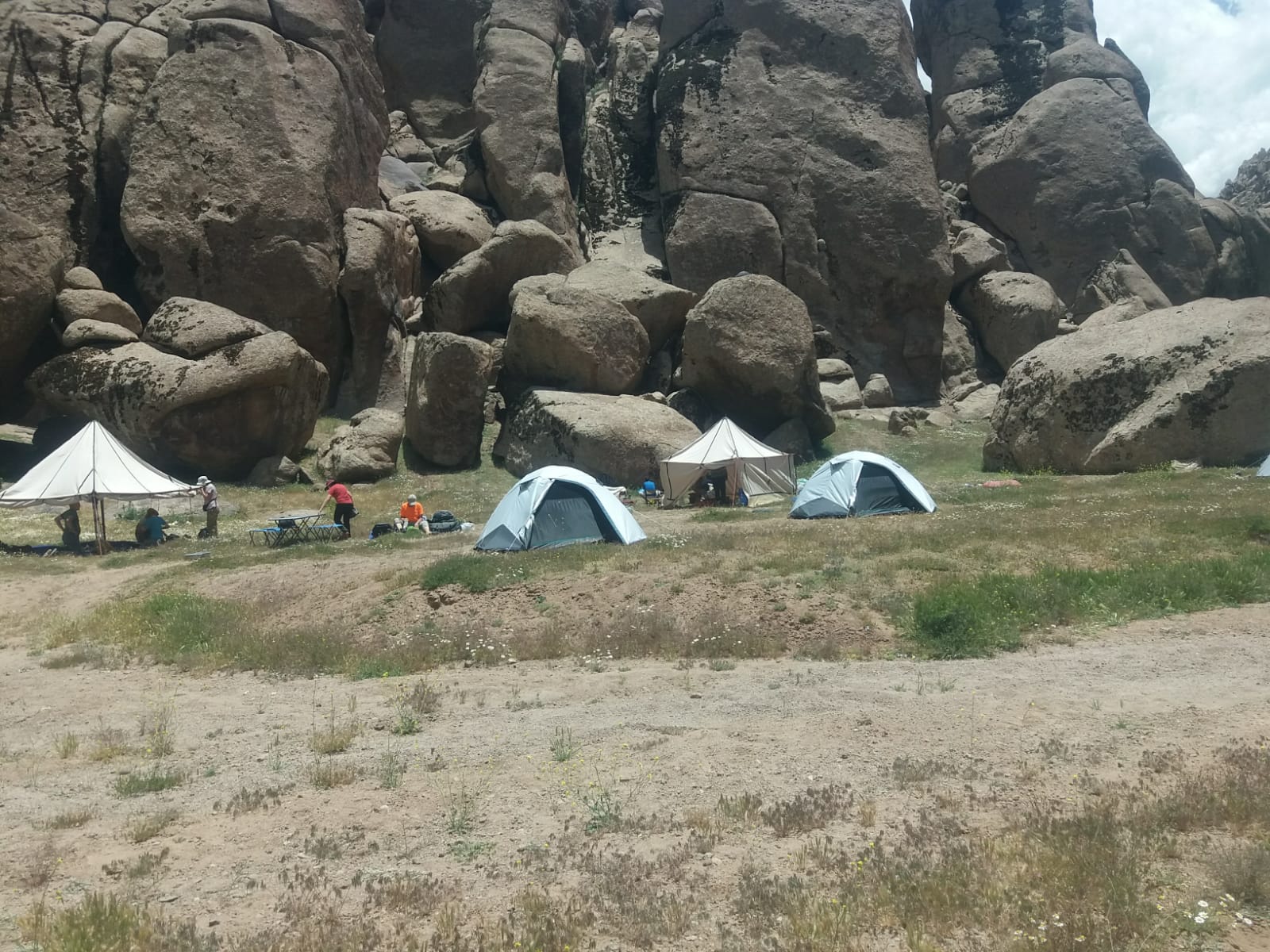
- Kitchen and bivouac equipment (kitchen tent, two-person igloo tents, foam mattresses).
NOT INCLUDED:
- flight, meals in town, hotels in Ouarzazate or Marrakech (hotel on request and according to category), drinks & tips, Insurance.